Iceland · aurora forecast for the nights aheadAuroraRadar.pro
Find out where and when you’ve got the best shot at the northern lights in Iceland. A simple 0–100 score (it factors in the Kp aurora forecast, the weather and three layers of cloud – plus, for the current hour, the live Bz reading from the solar wind) tells you whether it’s worth heading out to look.
But it’s still just a forecast – it can change as fast as Icelandic weather, so keep refreshing the page and the readings.
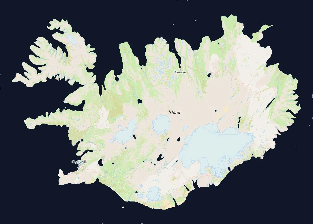
Pick a region of Iceland or a specific spot on the map and check your chances of catching the aurora. And if you want to know more about the aurora itself – how it forms, the numbers this page shows and the satellites that measure them – have a look at the Aurora guide below.
The numbers in the aurora band are a score from 0 to 100: how well conditions line up in that hour – aurora activity, cloud cover, darkness, moon phase and light pollution from towns. It’s not a percentage chance or a probability: 100 means a perfect night, which practically never happens.
0–11 poor12–29 moderate30–54 good55+ great conditions
aurora band: brighter and a higher number = a better hourcloud layers at their own heights: % of sky covered; cloud icons: one up to 33 %, two up to 66 %, three above thattwilight (not fully dark yet)best time
Support the project
AuroraRadar.pro is free. If it helped you get under a clear sky at the right time, or plan your trip – buy me a coffee. The coffees pay for new spots, translations and keeping the data flowing. And if we ever bump into each other somewhere under the Icelandic sky – high five. Cheers, Maciek.
Bz south – good for the auroraBz north – shield closedwind not measured yet↑↓direction of the wind’s magnetic field (Bz)
Auroral oval now
2 %90 %
What the numbers mean
thresholds as used by NOAA, IMO and SpaceWeatherLive
Score 0–100one number instead of five charts
For every hour of the night we multiply four things: aurora activity (from the Kp forecast), clear sky, darkness (whether the sun is low enough yet) and the moon (the brighter and higher it is, the fainter the aurora you can see; below the horizon it doesn’t matter). A spot’s score is its best hour; the “best time” is the hours when the score stays close to that peak. 100 means a perfect night, which almost never happens. The region score is the score of the best spot in that region – because that’s where it’s worth going – and the description adds how much cloud hangs over the rest of the region. Spots in towns get an extra light-pollution factor (e.g. Reykjavík 0.66, Akureyri 0.54), because you won’t see a faint aurora under street lights.
0–11 poor12–29 moderate30–54 good55+ great conditions
“Now” scorethe same formula, but using live solar wind instead of the Kp forecast
The overnight forecast is based on Kp, which is a 3-hour average for the whole planet and lags behind what’s happening above your head. That’s why for the current hour we also work out a “now” score: from the solar wind measurements (Bz, Bt, speed, density) we estimate an equivalent Kp using the Newell coupling function (2007) – the more southward the Bz, the stronger the field and the faster the wind, the more energy pours into the magnetosphere – and plug it into the same formula with clouds, darkness, moon and light pollution. It’s an estimate for the next 30–60 minutes, because that’s how long the wind takes to travel from the spacecraft to Earth. The night score tells you whether to plan a trip; the “now” score tells you whether to step outside right now. After dark the same reading also counts on the map, in the ranking and on the chart: the current hour of tonight takes its Kp from the solar wind instead of the forecast, so a sudden jump in activity shows up straight away in the region colours.
Kp (0–9)how disturbed Earth’s magnetic field is
A planetary index calculated every 3 hours from a worldwide network of magnetometers (GFZ Potsdam); NOAA publishes a forecast of it for the coming days. The higher the Kp, the further south the auroral oval reaches. Iceland sits right under the oval, so even Kp 1–2 gives you a chance with clear skies; at Kp 3–4 the aurora is overhead; from Kp 5 we’re talking about a geomagnetic storm (G1–G5 scale), visible even from Scotland or the northern US.
Remember: Kp is a 3-hour average for the whole planet. The aurora can “explode” for fifteen minutes even at a low Kp – that’s why we show the live “now” reading next to the forecast.
IMO forecast (0–9)Iceland’s own scale for the coming night
Veðurstofa Íslands publishes its own 0–9 number for every night, 10 days ahead, based on the NOAA forecast and local experience. It roughly matches the expected Kp: 0–1 quiet, 2–3 aurora visible with clear skies, 4–5 bright and moving, 6+ storm. Icelanders read this number together with the IMO cloud map – which is exactly what we combine into one score.
0–1 quiet2–3 visible4–5 bright6–9 storm
Bz (nT)the key number for “now”
The north–south component of the magnetic field carried by the solar wind. When it’s negative (“southward”), it links up with Earth’s field and lets energy into the magnetosphere – that’s when the aurora grows. A positive Bz shuts the door. It changes minute by minute, so Bz is the one to watch once you’re already out under the sky.
Bt (nT)strength of the solar wind’s magnetic field
The total strength of the field (Bz is part of it). A high Bt means big potential – but only if Bz turns south. Typically 3–8 nT; when a coronal mass ejection (CME) passes, it can jump to 20–40 nT.
below 10 typical10–20 elevated20–30 strongabove 30 very strong
Speed (km/s) and density (p/cm³)how hard the solar wind is pushing on Earth
Speed tells you how fast the particles hit the magnetosphere; a fast stream (from a coronal hole or a CME) delivers more energy. Density is the number of protons per cubic centimetre – dense wind gives a brighter, “juicier” aurora, as long as Bz plays along.
300–400 km/s calm400–500 elevated500–700 highabove 700 very high1–10 p/cm³ typicalabove 20 denseabove 40 very dense
Hemispheric power (GW)how much energy the aurora pumps into the atmosphere
NOAA’s OVATION model estimates every 5 minutes how many gigawatts of energy the aurora is dumping into the upper atmosphere of the northern hemisphere. It’s the simplest single number for “how much aurora is there right now” – about 30–60 minutes ahead, because the model works from solar wind measured before it reaches Earth.
The 30–60 minute delayhow we know “now” before the aurora shows up
The solar wind is measured by a NOAA spacecraft at the L1 point, about 1.5 million km upstream of Earth. At a typical 400 km/s, the same bit of wind reaches us about an hour later; at 800 km/s – half an hour later. So “now” on this page is really a forecast for the next half hour to an hour.
Cloud cover (%)the only thing that really makes one place different from another in Iceland
An hourly forecast from MET Norway for every spot, in three layers – just like the “lower / middle / high” tabs on the vedur.is cloud maps. Low and middle clouds block the aurora completely and count in full; high clouds (cirrus) let a bright aurora through, so they count half. The percentage is how much of the sky is covered. Aurora activity is almost the same across the whole country, so it’s the clouds that decide where to go.
0–30 % clear30–60 % a gamble – check the windowabove 70 % probably not
Darkness and twilighthow low the sun needs to go
After sunset the sun sinks below the horizon in stages: civil twilight (0 to −6°), nautical (−6 to −12°) and astronomical (−12 to −18°). You’ll see a faint aurora only from nautical twilight, and properly from astronomical. The score works out the sun’s height hour by hour for every spot and counts darkness gradually: 15–50 % in civil twilight, 50–100 % in nautical, and in full from −12°. Twilight hours are hatched on the chart. In Iceland there’s no full darkness at all from mid-May to the end of July, while in December it lasts from about 17:00 to 9:00.
Moonphase and whether it’s in the sky
How much of the disc is lit, and when the moon rises or sets. A full moon brightens the sky and drowns out a faint aurora (a strong one doesn’t care), but it lights up the landscape beautifully for photos. It’s not just the phase that matters, but whether the moon is actually in the sky – the score checks that hour by hour for every spot: below the horizon the moon doesn’t count at all, and low down (under 10°) only a little.
Sky darkness (mag/arcsec²)how much city lights brighten the sky
Sky brightness overhead from a light-pollution atlas, modelled from VIIRS satellite images of night-time lights from 2025. The higher the number, the darker: a natural sky with no artificial light is about 22.0 mag/arcsec², suburbs about 20, a city centre below 19. It’s a model, not a measurement, and it describes the sky overhead – the glow low above the horizon towards a town can be brighter. The score turns this number into a light-pollution factor: no penalty down to about 21.2, roughly half in a city centre. The “Dark sky” switch above the map shows the whole layer, and each spot’s card tells you where the nearest darker sky is.
Inside Iceland’s interior and over Vatnajökull the atlas shows a false glow from the glaciers (the satellite picks up reflections from snow and ice), so there we assume natural darkness.
21.8+ very dark21.5–21.8 dark20.9–21.5 slight glow20.0–20.9 noticeable glow19.0–20.0 strong glowbelow 19 city
Feels-like temperaturebecause you’ll be waiting for hours
The forecast temperature adjusted for wind (the wind chill formula used by weather services in Canada and the US). At −2 °C with a 10 m/s wind, it feels like about −11 °C. Wind is the norm on the Icelandic coast, so this number tells you more than the thermometer does.
Where the data comes from
Aurora activity
NOAA SWPC – Kp index forecast, solar wind measurements (Bz, Bt, speed, density) from the spacecraft at L1 and hemispheric power from the OVATION model. Veðurstofa Íslands (IMO) – its own 0–9 aurora forecast for every night.
Cloud, temperature, wind
MET Norway (Locationforecast) – low, middle and high cloud, temperature and wind every hour, separately for each of the 38 spots. Feels-like temperature calculated from wind (wind chill).
Darkness and moon
Sunset and sunrise, full darkness and the moon phase – from Veðurstofa Íslands (IMO), refreshed every 6 hours. The heights of the sun and the moon above the horizon we work out ourselves, hour by hour for every spot.
Map
Base map: OpenStreetMap (ODbL licence, attribution only). The 12 regions are our own split – the borders run halfway between the regions’ nominal centres and stop at the coastline.
Sky darkness
Light-pollution atlas – a sky-brightness model based on VIIRS night-time lights (Earth Observation Group, Payne Institute, Colorado School of Mines). Resolution about 1 km.
For live comparison
SpaceWeatherLive – Kp charts, solar wind, the auroral oval, webcams. It shows the same NOAA data we use; we don’t embed their charts (their terms don’t allow it), but we link to them.
Aurora guide
How to hunt the northern lights
Where the light in the sky comes from, which numbers really matter, how to read SpaceWeatherLive and vedur.is, and how to plan a night out by car in Iceland.
The aurora isn’t a lottery. To see it, four things have to line up at once. You can check three of them on your phone – the fourth is down to you.
Darkness
A night with the sun well below the horizon and no street lights. In Iceland that’s from late August to mid-April.
Clear sky
The aurora glows 100 km up, clouds hang at 1–10 km. Clouds always win.
Activity
The solar wind has to “open the gate” in Earth’s magnetic field. That’s what the Bz number tells you.
Patience
The aurora comes in waves of 10–30 minutes. Most people head back to the hotel fifteen minutes too early.
1. Where the aurora comes from
The aurora is a neon sign the size of a continent. The Sun supplies the power, Earth’s magnetic field is the cable, and the upper atmosphere is the glowing gas.
The Sun constantly blows a stream of charged particles (electrons and protons) into space. That’s the solar wind. It takes a day and a half to four days to reach us, and it carries a piece of the Sun’s magnetic field with it.
Earth has its own magnetic field – an invisible shield called the magnetosphere. Usually the solar wind flows around it like water around a stone in a river. Everything changes when the magnetic field carried by the wind points south, the opposite way to Earth’s. Then the two fields “stick together” (physicists call it reconnection), the shield opens up and energy pours into the long tail of the magnetosphere on Earth’s night side. Every so often the tail “snaps” like a stretched rubber band and fires particles along the field lines straight towards the poles.
Flip the field direction in the animation and see the difference.
Why the aurora is green – and sometimes red or pink
Fast electrons slam into oxygen atoms and nitrogen molecules. The atom that gets hit picks up extra energy for a moment, then gives it back as a flash of light in a very specific colour. The colour depends on what the electron hit and at what height.
Red, 200–400 km
Oxygen in very thin air. Faint, and mostly visible during strong storms. It’s the colour people most often see from further south, because from far away you only see the top of the aurora.
Green, 100–200 km
Atomic oxygen. The brightest colour and the one the human eye is most sensitive to. That’s 90% of what you’ll see in Iceland.
Pink and violet, 80–100 km
Nitrogen. It shows up along the lower edge of the curtains when the aurora is very active and dancing fast.
For comparison: planes fly at 11 km, and clouds end even lower.
Fair warning: to the naked eye a faint aurora looks like a greyish-white, slightly greenish streak – easy to mistake for a cloud. Your eyes don’t see colour well in the dark, while a camera collects light for several seconds. The hunters’ trick: take a photo with your phone’s night mode. If the “cloud” comes out green, it’s not a cloud.
2. The numbers worth understanding
If you remember just one thing: watch Bz, not Kp. Kp tells you what happened over the last three hours. Bz tells you what will happen in 30–60 minutes.
Solar wind data comes from a satellite parked 1.5 million km from Earth towards the Sun (the L1 point). Wind that has passed it usually reaches us 30–70 minutes later. That’s your only real “window into the future”.
Simulator: set up the space weather
Move the sliders and watch what happens to the sky over Iceland. The model is deliberately simplified – it’s there to build your intuition, not to replace a forecast.
3. Forecasts: days, hours, minutes
An aurora forecast works like a storm forecast: the closer you get, the more certain it is. Every time horizon has its own data source.
27 days ahead
The Sun spins on its axis about once every 27 days. If a coronal hole (a dark patch on images of the Sun that blows out fast wind) gave us aurora a month ago, it’ll probably do it again. That’s how long-range forecasts work – treat them as a hint, nothing more.
1–4 days ahead
Two sources of aurora. A coronal hole facing Earth: fast wind arrives in 2–4 days and gives a few calm but reliable nights. A coronal mass ejection (CME): a cloud of plasma thrown out after a flare, travelling 1–3 days – it can give you the show of your life, or… nothing at all if it brings a northward Bz. A flare on its own doesn’t cause aurora – what matters is whether it launched a CME our way. This is where the 3-day forecast and the Kp forecast come in handy.
30–70 minutes ahead
The wind passes the satellite at L1. From that moment you know the real Bz, Bt, speed and density. This is the key decision point: drive out or go to bed.
Now
Magnetometers (a sudden drop in the line = the aurora is flaring up right now), webcams, the auroral oval map and the best instrument of all – your own eyes pointed north.
Where are we in the solar cycle? Solar activity rises and falls on a roughly 11-year rhythm. The peak of the current cycle, number 25, came around 2024. The years just after the maximum are great for hunters: there are fewer huge flares, but more big coronal holes that give regular, repeating aurora. On top of that, around the equinoxes (September–October and March) Earth’s field statistically “links up” with the Sun’s more easily, so there’s more aurora.
4. How to read SpaceWeatherLive
The site’s home page looks like an aeroplane cockpit. For hunting you need four dials – the rest is background. Below is a sketch of the page – click any panel.
The site has two tabs: Auroral activity (what’s happening around Earth – your main tab) and Solar activity (what’s happening on the Sun – a preview of the next few days). The values on the sketch are just examples.
A three-minute routine on the site
Kp forecast for three days – a quick look in the morning. For Iceland Kp 2–3 is already a good night, so low values are no reason to give up.
Bz – is it negative, and for how long? Hit “More data” and look at the chart for the last 2 hours. Half an hour of steady negative Bz is worth more than a single deep dip.
Speed and Bt – the higher they are, the stronger the effect for the same Bz. The site also tells you straight away how many minutes until the measured wind reaches Earth.
Auroral oval – the oval map. Is the green band over Iceland? Is it turning yellow or red?
Magnetometers – when the line starts dropping sharply, get outside. The aurora is flaring up right now.
Finally the moon phase and – outside the site – the Icelandic Met Office cloud map (lesson 5).
Alerts instead of staring at the screen. The site has a phone app and notifications. Sensible thresholds for Iceland: Bz below −8 nT, Kp 4 and up, Hemispheric Power above 50 GW. Remember that mobile coverage can be patchy outside towns – check the data before you head out.
5. Hunting in Iceland
Iceland sits right under the auroral oval. There’s activity almost every night. Your real enemy isn’t the Sun, it’s Icelandic cloud – and that’s why a car is your biggest advantage.
When it’s dark enough
The height of each bar is a rough number of hours of real darkness around Reykjavík. Click a month.
Time of night: the aurora can show up any time after dark, but statistically the best window is 22:00–1:00. Plan to be in place and ready by 21:30 – not to be setting off then.
Clouds: how to read the vedur.is map
The Icelandic Met Office (Veðurstofa, vedur.is) has a separate forecast just for aurora hunters. It’s the most important website of your trip. You read it the opposite way to what your intuition tells you:
White areas = clear sky. Green = cloud, and the darker the green, the thicker it is. You’re looking for white.
The slider under the map moves through time hour by hour. Check the 21:00–2:00 window and see which way the gaps in the cloud are moving.
You can switch the map between low, middle and high cloud. Low and middle are the dangerous ones. A bright aurora can shine through thin high cloud.
The number in the corner (0–9 scale) is the activity forecast. In Iceland even “2–3” means a real chance, so it’s the clouds that decide whether you go, not that number.
Strategy with a car or campervan
Pick a direction in the afternoon. Compare the evening cloud map with a road map. Often 40–90 minutes of driving is enough: when the south is cloudy, it’s often clear on the lee side of the mountains and glaciers – and vice versa.
Find your spot in daylight. A car park or lay-by with an open view to the north, away from lights. You don’t go looking for turn-offs on an unfamiliar road in the dark.
Check the road and the wind. Road conditions: umferdin.is (phone line 1777). Warnings: safetravel.is and vedur.is. With a yellow or orange wind warning, stay put – the aurora will be there tomorrow too.
Switch everything off. The engine can keep running for warmth, but headlights, daytime running lights and the dashboard screen ruin your night vision and everyone else’s. Your eyes need about 20 minutes in the dark. Use the red light on your head torch.
Wait with a plan. Decide how long you’ll stay (e.g. until 1:00). Dress warmer than seems sensible and bring a flask. A calm arc in the north often turns into a dance overhead after 20–40 minutes.
Safety – because that’s what most often ruins trips:
Never stop on the carriageway or on the narrow shoulder of Route 1. Car parks and lay-bys only.
Hold the door with both hands when you open it – Icelandic wind rips doors off their hinges, and no insurance covers that.
In winter black ice appears after dark, even on main roads. Mountain roads (F-roads) are closed roughly from October to June.
Reynisfjara and the other southern beaches: in the dark, keep well back from the water – waves can surge dozens of metres up the beach.
Campervans: sleeping “wild” in a vehicle is banned in Iceland without the landowner’s permission. In winter only some campsites are open – check the list before you go.
Emergency number: 112.
Tried-and-tested spots
The list of spots with descriptions, tonight’s forecast and Google Maps links is in the radar at the top of the page:jump to the spot ranking. The aurora is the same everywhere – spots differ in foreground, darkness and how easy they are to reach in winter.
If you’re based in Reykjavík: city lights kill a faint aurora, but just 30–45 minutes’ drive (Þingvellir, Kleifarvatn, around Hvalfjörður) gets you proper darkness. Grótta lighthouse is the fallback for an evening without a car.
All 38 viewing spots – short descriptions
Reykjavík / Grótta Höfuðborgarsvæðið
Grótta lighthouse on the Seltjarnarnes headland, 15 minutes from downtown: the darkest spot in the city, looking north over the bay. Reykjavík’s glow stays behind you, but you won’t catch a faint aurora here. Note: The causeway to the lighthouse island disappears at high tide – stay in the car park by the beach.
Þingvellir Suðurland
A national park 45 minutes from the capital: real darkness, a wide sky over Lake Þingvallavatn and big car parks (Hakið). The classic first choice if you’re based in Reykjavík. Note: Car park P1 is paid (machine); in winter the steps down to the Almannagjá rift are slippery.
Vík í Mýrdal / Reynisfjara Suðurland
A village on the south coast and the south’s most popular base, with the black-sand beach of Reynisfjara 10 minutes away – basalt columns and the Reynisdrangar sea stacks. The hilltop church makes a foreground in Vík, the beach gives you the rocks; mountains block the low northern horizon, so save it for stronger nights. Note: Sneaker waves at Reynisfjara surge dozens of metres up the beach, at night too. Stay close to the car park.
Jökulsárlón Suðausturland
The glacier lagoon: aurora reflected in the water between drifting icebergs. For many the best shot on the island – zero lights, and the car park is right by Route 1. Note: 4.5 hours from the capital; base yourself in Höfn (1 hr) or around Skaftafell.
Kirkjufell Snæfellsnes
Iceland’s most famous mountain, in Grundarfjörður on the Snæfellsnes peninsula. You look north over the Kirkjufellsfoss waterfall – exactly where the aurora starts. Note: Paid car park, and on good nights it’s a forest of tripods. Don’t climb onto the ice by the falls.
Akureyri Norðurland
The capital of the north (19,000 people) and your base for Mývatn. Statistically less cloud than the south in winter, and the auroral oval sits right overhead. Note: Town lights: drive 10–15 minutes out along the fjord (e.g. towards Hjalteyri) or up to the Víkurskarð pass.
Mývatn Norðurland
Lake Mývatn with its pseudocraters, lava fields and hot springs; base yourself in Reykjahlíð. Dark, flat, an open horizon – and Route 1 is kept clear in winter.
Goðafoss Norðurland eystra
A waterfall on Route 1 between Akureyri and Mývatn, car park open all year, 35 minutes from Akureyri. A wide arc of water for your foreground and no lights apart from the car park. Note: In winter the railings and paths are icy – stick to the marked viewing platforms.
Skógafoss Suðurland
A 60 m waterfall on Route 1 with a big car park and no floodlights at night. There’s a campsite and a hotel right there, so you can wait somewhere warm. Note: Spray settles on your lens – bring a cloth.
Gullfoss Suðurland
The waterfall at the end of the Golden Circle, 1.5 hours from the capital. The upper car park stays open at night, and once the café closes it gets empty and dark. Note: In winter the steps and viewing platforms are icy; watch the aurora from the upper platform.
Hella / Hvolsvöllur Suðurland
The southern lowlands, 90 minutes from the capital: lots of hotels and aurora cabins, flat and dark between the villages, with a clear view north towards Hekla.
Höfn í Hornafirði Suðausturland
A fishing town and your base for Vatnajökull and Jökulsárlón. The harbour itself is lit, but 15 minutes away is Stokksnes with Vestrahorn – the best foreground in the east.
Stokksnes / Vestrahorn Suðausturland
The jagged Vestrahorn mountain above a black beach and dunes, 15 minutes from Höfn. The best foreground in the east, with reflections in the wet sand. Note: Private land – pay the entry fee at the Viking Café; after dark don’t drive off the gravel road onto the sand.
Kirkjubæjarklaustur Suðurland
A village on Route 1, halfway along the 270 km gap between Vík and Jökulsárlón: the Eldhraun lava fields, a petrol station and places to stay. Flat, dark, open horizon in every direction.
Selfoss Suðurland
The biggest town in the south, 60 km from the capital, where the roads to the coast meet. More a weather reference point and a place to sleep than a viewing spot. Note: Drive 10 minutes out of town, e.g. towards Eyrarbakki.
Reykjanesviti Reykjanes
Iceland’s oldest lighthouse at the tip of the Reykjanes peninsula, 50 minutes from the capital: cliffs, the Gunnuhver geothermal area and no lights apart from the lighthouse. Note: Eruption area 2023–2025: roads around Grindavík are sometimes closed. Check safetravel.is before you go.
Kleifarvatn Reykjanes
A lake in a crater valley on Reykjanes, 35 minutes from the city. Black shores and reflections – a good alternative when clouds hang over Þingvellir. Note: Road 42 is partly gravel and slippery in winter.
Garður Suðurnes
The Garðskagaviti lighthouses at the very tip of the peninsula, 10 minutes from Keflavík airport. A flat 360-degree horizon – perfect for your first or last night.
Stykkishólmur Snæfellsnes
A harbour town on the north side of Snæfellsnes. Súgandisey hill with its lighthouse looks out over Breiðafjörður and its hundreds of islets.
Húsavík Norðurland
The whale-watching town on Skjálfandi Bay, with a wooden church and the harbour for your foreground. A base for the northeast.
Egilsstaðir Austurland
The main town in the east, with an airport and a road junction. Lake Lagarfljót and Hallormsstaður forest give you dark spots 10–20 minutes from town.
Djúpivogur Austurland
A harbour town on the east coast, halfway between Höfn and Egilsstaðir. Búlandstindur mountain above the fjord makes the foreground, and the harbour is only dimly lit.
Ísafjörður / Bolungarvík Vestfirðir
The capital of the Westfjords and its neighbour through the tunnel. In Ísafjörður itself the deep fjord gives you a narrow horizon; 15 minutes away, the Óshólaviti lighthouse in Bolungarvík opens up the view north over the sea. Note: Frequent road closures and avalanche risk in winter – this region is for longer, self-sufficient trips.
Borgarnes Vesturland
A town at the bridge over Borgarfjörður, an hour from the capital and a popular overnight stop heading west. Dark fields and coastline 5 minutes out of town.
Akranes Vesturland
A town 45 minutes from the capital with the two Breið lighthouses on the point: a favourite of aurora photographers from the Reykjavík area, with an open view north and west.
Hvítserkur Norðurland vestra
The rock “dragon” drinking from the sea on the Vatnsnes peninsula, 40 minutes off Route 1. A one-of-a-kind shot, with the northern sky right above the rock. Note: The last dozen or so kilometres are gravel – in winter only in good conditions; steep path down to the beach.
Seyðisfjörður Austurland
A colourful little town at the head of a narrow fjord (ferry from Denmark). Pretty, but the mountains block most of the sky, so you only see the aurora when it’s high. Note: The Fjarðarheiði pass is sometimes closed in winter; once the tunnel opens (2026+), that will be the way in and out.
Vestmannaeyjar Suðurland
Heimaey island with the Eldfell volcano, a 35-minute ferry from Landeyjahöfn. Dark and exotic, but winter sailings are sometimes cancelled. Note: You’ll need to stay overnight on the island – the last ferry leaves in the evening.
Siglufjörður Norðurland vestra
The former herring capital in the far north, reached through tunnels. A narrow fjord, but often a clear sky when the rest of the north is under cloud.
Dalvík Norðurland eystra
A small town on Eyjafjörður with the ferry to Grímsey. An open view over the fjord and the Tröllaskagi mountains.
Sauðárkrókur Norðurland vestra
A town on Skagafjörður, on the way between the capital and Akureyri. A flat coastline looking out to Drangey island.
Blönduós Norðurland vestra
A town on Route 1 in the northwest, a typical overnight stop halfway to Akureyri. The river mouth and the Húnaflói coast are right next to it.
Reyðarfjörður / Neskaupstaður Austurland
A base in the East Fjords: Reyðarfjörður and Eskifjörður are on the main road, and through the tunnel Neskaupstaður sits at the end of the road, with a fjord open to the east and a dark sky. Note: The aluminium smelter in Reyðarfjörður is lit all night; for viewing, head to Eskifjörður or Neskaupstaður.
Hólmavík Vestfirðir
A village on the Strandir coast on the eastern side of the Westfjords, 3 hours from the capital. Very dark, very empty, and there’s a museum of witchcraft. Note: Three hours from the capital; Road 61 over Steingrímsfjarðarheiði is sometimes closed in winter.
Patreksfjörður Vestfirðir
A small town in the southern Westfjords, a base for the Látrabjarg cliffs and Rauðasandur beach. Very hard to reach in winter. Note: Very hard to reach in winter: mountain passes, gravel stretches and frequent closures. Check umferdin.is before you set off.
Bláa lónið Reykjanes
The Blue Lagoon: the spa and hotels are brightly lit all night, and it sometimes closes during eruptions on Reykjanes. A tourist magnet, but a poor spot for aurora. Note: The spa and hotels are brightly lit all night, and it sometimes closes during Reykjanes eruptions. Reykjanesviti, 20 minutes away, is much better.
Dettifoss Norðurland
Europe’s most powerful waterfall. Impressive in summer, but roads 862 and 864 are closed from the first snow until May – that’s the whole aurora season. Note: Roads 862 and 864 are closed from the first snow until May, i.e. for most of the aurora season. In winter, go to Goðafoss instead.
Landmannalaugar Suðurland
The colourful mountains of the Highlands, reachable only on F-roads, which are closed from October to June. You can’t get there during the aurora season. Note: F-roads are closed from October to June, so it’s out of reach in aurora season. It stays on the map as a summer spot (late August–September).
6. Photographing the aurora
There’s one rule: the camera has to stay perfectly still and collect light for a few seconds. The rest is matching the exposure time to how fast the aurora is moving.
Camera on a tripod
Phone
Camera: set everything up in daylight
Lens: wide-angle (14–24 mm on full frame) and as bright as possible: f/1.4–f/2.8. Take off the UV filter – in aurora shots it can cause strange concentric rings.
Manual focus. Autofocus doesn’t work in the dark. Turn on live view, zoom in on a bright star or a distant light and turn the ring until the point is as small as it gets. You can tape the ring in place.
M mode, RAW format, white balance around 3500–4000 K, stabilisation off (it hurts on a tripod), 2-second self-timer or a remote release.
Cold eats batteries. Keep a spare in an inside pocket. When you get back to the car, don’t take the camera out of the bag straight away – it’ll fog up.
The foreground makes the photo. A waterfall, a little church, a person’s silhouette, a reflection in water. Plain green sky gets boring fast.
Phone: yes, on one condition
Keep it still. A mini tripod with a holder, or rest it on a rock or the car window. Handheld, you’ll get a blurry smudge.
Turn on night mode and set the longest time available (on a tripod the iPhone allows 10–30 s; on Android phones look for “Pro” or “Night” mode: ISO 1600–3200, 4–10 s, focus manually at infinity).
Turn off the flash, use a 3-second self-timer and save RAW if your phone can.
Turn your screen brightness right down – a bright screen ruins your night vision and bothers the people next to you.
Take a few shots, then put the gear away. The best aurora moments last a few minutes – it’s a shame to watch them through a screen.
7. Glossary and useful websites
Glossary
Solar wind
A steady stream of charged particles from the Sun. Usually 300–500 km/s, gusting to over 800.
IMF, Bt and Bz
The interplanetary magnetic field carried by the wind. Bt is its total strength, Bz the north–south component. A negative Bz opens up the magnetosphere.
Kp index
A global, three-hour measure of how disturbed Earth’s magnetic field is, on a 0–9 scale. From Kp 5 it’s a geomagnetic storm (G1); Kp 9 is G5.
Auroral oval
The ring around the magnetic pole where the aurora glows. The stronger the activity, the wider it gets and the further south it reaches.
Substorm
A sudden release of energy from the tail of the magnetosphere. It lasts 10–30 minutes, and that’s exactly when the aurora “explodes” with movement and colour.
CME
Coronal mass ejection: a cloud of plasma thrown out by the Sun. The source of the strongest aurora.
Coronal hole
A region on the Sun that fast wind escapes from. The source of regular aurora that comes back about every 27 days.
L1 point
A point 1.5 million km from Earth towards the Sun, where the satellites that measure the solar wind sit before it reaches us.
Hemispheric Power
An estimate of the aurora’s total power over a hemisphere, in gigawatts. A quick “how much is going on right now” number.
When is the best time to see the northern lights in Iceland?
From late August to mid-April, when the nights are properly dark. The best window is usually 22:00–1:00, and around the equinoxes (September–October and March) the aurora shows up statistically more often. From mid-May to the end of July it never gets dark in Iceland at all.
What Kp index do you need to see the aurora in Iceland?
Iceland sits right under the auroral oval, so with a clear sky Kp 2–3 is enough, and even at Kp 1 you can often see an arc low in the north. Clouds and a negative Bz in the solar wind matter more than Kp – that’s why the radar combines all of them into one score.
Where can you see the northern lights near Reykjavík?
Inside the city the darkest spot is Grótta lighthouse, but the glow of the lights washes out a faint aurora. For proper darkness go to Þingvellir (about 45 minutes’ drive), Lake Kleifarvatn (about 35 minutes) or the lighthouses at Akranes (about 45 minutes). All of them are in the radar’s ranking with a forecast for every night.
How does the 0–100 score on AuroraRadar.pro work?
For every hour of the night and each of the 38 spots, the radar multiplies four factors: aurora activity (the Kp forecast, and for the current hour the live solar wind), cloud cover in three layers, darkness (the sun’s height) and the moon. A spot’s score is its best hour; 100 means a perfect night, which almost never happens.
Where does the data come from and how often is it updated?
Aurora activity, the solar wind and the auroral oval come from NOAA SWPC; the 0–9 aurora forecast, sun, moon and weather warnings from the Icelandic Met Office (Veðurstofa Íslands, IMO); cloud, temperature and wind from MET Norway. The solar wind is refreshed every 20 minutes, the weather for each spot every hour, and the IMO data every 6 hours.
Is AuroraRadar.pro free?
Yes. It runs in your browser, with no login and no app to install, in seven languages: English, Icelandic, German, French, Italian, Spanish and Polish. You can add it to your phone’s home screen and open it like an app.
With your consent I count visits with Google Analytics (cookies). More


 Buy me a coffee